Fill Out Your Fema Elevation Form
The FEMA Elevation Certificate plays a crucial role in the National Flood Insurance Program (NFIP), serving as an essential tool for communities dealing with floodplain management. By collecting necessary elevation information, this certificate helps determine the appropriate insurance premium rates for properties located in Special Flood Hazard Areas. Among its many uses, the form supports requests for Letters of Map Amendment (LOMA) or Letters of Map Revision due to fill (LOMR-F). For buildings constructed after the publication of the Flood Insurance Rate Map (FIRM), the Elevation Certificate is mandatory to ensure compliance with local floodplain management regulations. This includes documenting the elevation of the building's lowest floor, which is vital for assessing flood risk. The completed form must include not only measurements from a licensed surveyor or engineer but also details about the building's location and flood zone classification. Furthermore, while the Elevation Certificate facilitates the acquisition of flood insurance, it does not exempt property owners from purchasing flood insurance, as only a LOMA or LOMR-F can amend such requirements. Property owners, insurance agents, and community officials will find this certificate invaluable in navigating the complexities of flood insurance and compliance with federal regulations.
Fema Elevation Example
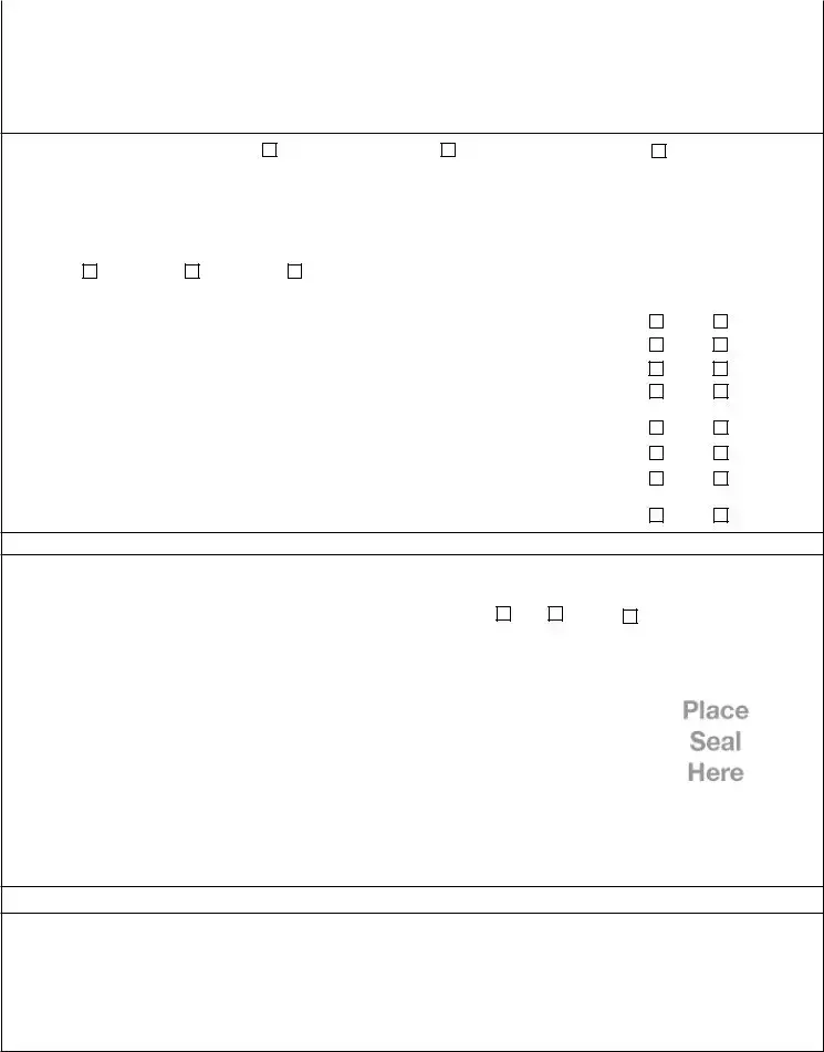
NATIONAL FLOOD INSURANCE PROGRAM
ELEVATION CERTIFICATE
AND
INSTRUCTIONS
2019 EDITION
OMB No.
Expiration Date: November 30, 2022
U.S. DEPARTMENT OF HOMELAND SECURITY
Federal Emergency Management Agency
National Flood Insurance Program
ELEVATION CERTIFICATE AND INSTRUCTIONS
Paperwork Reduction Act Notice
Public reporting burden for this data collection is estimated to average 3.75 hours per response. The burden estimate includes the time for reviewing instructions, searching existing data sources, gathering and maintaining the data needed, and completing and submitting this form. You are not required to respond to this collection of information unless a valid OMB control number is displayed on this form. Send comments regarding the accuracy of the burden estimate and any suggestions for reducing the burden to: Information Collections Management, Department of Homeland Security, Federal Emergency Management Agency, 500 C Street SW, Washington, DC 20742, Paperwork Reduction Project
Privacy Act Statement
Authority: Title 44 CFR § 61.7 and 61.8.
Principal Purpose(s): This information is being collected for the primary purpose of estimating the risk premium rates necessary to provide flood insurance for new or substantially improved structures in designated Special Flood Hazard Areas.
Routine Use(s): The information on this form may be disclosed as generally permitted under 5 U.S.C. § 552a(b) of the Privacy Act of 1974, as amended. This includes using this information as necessary and authorized by the routine uses published in DHS/
Disclosure: The disclosure of information on this form is voluntary; however, failure to provide the information requested may result in the inability to obtain flood insurance through the National Flood Insurance Program or the applicant may be subject to higher premium rates for flood insurance. Information will only be released as permitted by law.
Purpose of the Elevation Certificate
The Elevation Certificate is an important administrative tool of the National Flood Insurance Program (NFIP). It is to be used to provide elevation information necessary to ensure compliance with community floodplain management ordinances, to determine the proper insurance premium rate, and to support a request for a Letter of Map Amendment (LOMA) or Letter of Map Revision based on fill
The Elevation Certificate is required in order to properly rate
As part of the agreement for making flood insurance available in a community, the NFIP requires the community to adopt floodplain management regulations that specify minimum requirements for reducing flood losses. One such requirement is for the community to obtain the elevation of the lowest floor (including basement) of all new and substantially improved buildings, and maintain a record of such information. The Elevation Certificate provides a way for a community to document compliance with the community's floodplain management ordinance.
Use of this certificate does not provide a waiver of the flood insurance purchase requirement. Only a LOMA or
This certificate is used only to certify building elevations. A separate certificate is required for floodproofing. Under the NFIP, non- residential buildings can be floodproofed up to or above the Base Flood Elevation (BFE). A floodproofed building is a building that has been designed and constructed to be watertight (substantially impermeable to floodwaters) below the BFE. Floodproofing of residential buildings is not permitted under the NFIP unless FEMA has granted the community an exception for residential floodproofed basements. The community must adopt standards for design and construction of floodproofed basements before FEMA will grant a basement exception. For both floodproofed
Additional guidance can be found in FEMA Publication
FEMA Form |
Replaces all previous editions. |
U.S. DEPARTMENT OF HOMELAND SECURITY Federal Emergency Management Agency
National Flood Insurance Program
OMB No.
Expiration Date: November 30, 2022
ELEVATION CERTIFICATE
Important: Follow the instructions on pages
Copy all pages of this Elevation Certificate and all attachments for (1) community official, (2) insurance agent/company, and (3) building owner.
|
|
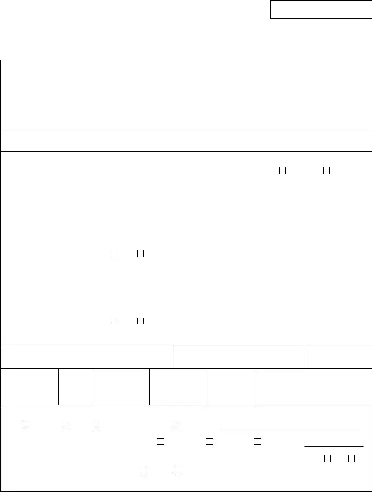
SECTION A – PROPERTY INFORMATION |
FOR INSURANCE COMPANY USE |
|
A1. Building Owner's Name |
Policy Number: |
|
|
|
|
|
|
A2. Building Street Address (including Apt., Unit, Suite, and/or Bldg. No.) or P.O. Route and |
Company NAIC Number: |
|
|
Box No. |
|
|
|
|
|
|
|
|
|
|
|
City |
State |
ZIP Code |
A3. Property Description (Lot and Block Numbers, Tax Parcel Number, Legal Description, etc.)
A4. Building Use (e.g., Residential, |
|
|
|
|
|
|
|||||||||||||||
A5. Latitude/Longitude: Lat. |
|
|
|
|
|
Long. |
|
|
|
Horizontal Datum: |
NAD 1927 |
NAD 1983 |
|||||||||
A6. Attach at least 2 photographs of the building if the Certificate is being used to obtain flood insurance. |
|
|
|
|
|||||||||||||||||
A7. Building Diagram Number |
|
|
|
|
|
|
|
|
|
|
|
|
|
|
|
|
|
|
|
||
A8. For a building with a crawlspace or enclosure(s): |
|
|
|
|
|
|
|||||||||||||||
a) |
Square footage of crawlspace or enclosure(s) |
|
sq ft |
|
|
|
|
||||||||||||||
|
|
|
|
|
|
|
|
|
|
|
|
|
|||||||||
b) |
Number of permanent flood openings in the crawlspace or enclosure(s) within 1.0 foot above adjacent grade |
|
|
|
|||||||||||||||||
c) |
Total net area of flood openings in A8.b |
|
|
|
|
|
sq in |
|
|
|
|
|
|
||||||||
d) Engineered flood openings? |
Yes |
No |
|
|
|
|
|
|
|||||||||||||
A9. For a building with an attached garage: |
|
|
|
|
|
|
|
|
|
|
|
|
|
||||||||
a) |
Square footage of attached garage |
|
|
|
|
|
|
|
|
sq ft |
|
|
|
|
|
|
|||||
b) |
Number of permanent flood openings in the attached garage within 1.0 foot above adjacent grade |
|
|
|
|
||||||||||||||||
c) |
Total net area of flood openings in A9.b |
|
|
|
|
|
|
sq in |
|
|
|
|
|
|
|||||||
d) Engineered flood openings? |
Yes |
No |
|
|
|
|
|
|
|||||||||||||
SECTION B – FLOOD INSURANCE RATE MAP (FIRM) INFORMATION
B1. NFIP Community Name & Community Number
B2. County Name
B3. State
B4. Map/Panel
Number
B5. Suffix
B6. FIRM Index Date
B7. FIRM Panel
Effective/
Revised Date
B8. Flood Zone(s)
B9. Base Flood Elevation(s)
(Zone AO, use Base Flood Depth)
B10. Indicate the source of the Base Flood Elevation (BFE) data or base flood depth entered in Item B9:
FIS Profile |
FIRM |
Community Determined |
Other/Source: |
B11. Indicate elevation datum used for BFE in Item B9: NGVD 1929 |
NAVD 1988 |
Other/Source:
B12. Is the building located in a Coastal Barrier Resources System (CBRS) area or Otherwise Protected Area (OPA)? |
Yes |
No |
|||
Designation Date: |
|
CBRS |
OPA |
|
|
FEMA Form |
Replaces all previous editions. |
Form Page 1 of 6 |
ELEVATION CERTIFICATE |
|
|
OMB No. |
|
|
|
Expiration Date: November 30, 2022 |
||
IMPORTANT: In these spaces, copy the corresponding information from Section A. |
FOR INSURANCE COMPANY USE |
|||
Building Street Address (including Apt., Unit, Suite, and/or Bldg. No.) or P.O. Route and Box No. |
Policy Number: |
|||
|
|
|
|
|
City |
State |
ZIP Code |
Company NAIC Number |
|
|
|
|
|
|
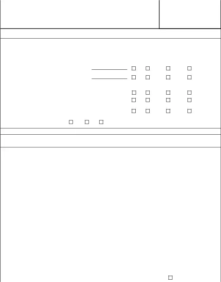
SECTION C – BUILDING ELEVATION INFORMATION (SURVEY REQUIRED)
C1. Building elevations are based on: |
Construction Drawings* |
Building Under Construction* |
Finished Construction |
*A new Elevation Certificate will be required when construction of the building is complete. |
|
||
C2. Elevations – Zones
Benchmark Utilized: |
|
|
|
|
Vertical Datum: |
|
|
|
|
|
||
Indicate elevation datum used for the elevations in items a) through h) below. |
|
|
|
|
||||||||
|
NGVD 1929 |
NAVD 1988 |
Other/Source: |
|
|
|
|
|
||||
Datum used for building elevations must be the same as that used for the BFE. |
Check the measurement used. |
|||||||||||
|
|
|
|
|
|
|
|
|
||||
a) |
Top of bottom floor (including basement, crawlspace, or enclosure floor) |
|
feet |
meters |
||||||||
b) |
Top of the next higher floor |
|
|
|
|
|
|
feet |
meters |
|||
c) |
Bottom of the lowest horizontal structural member (V Zones only) |
|
|
feet |
meters |
|||||||
d) |
Attached garage (top of slab) |
|
|
|
|
|
|
feet |
meters |
|||
e) |
Lowest elevation of machinery or equipment servicing the building |
|
feet |
meters |
||||||||
|
(Describe type of equipment and location in Comments) |
|
|
|||||||||
|
|
|
feet |
meters |
||||||||
f) |
Lowest adjacent (finished) grade next to building (LAG) |
|
|
|||||||||
g) |
Highest adjacent (finished) grade next to building (HAG) |
|
|
feet |
meters |
|||||||
h) |
Lowest adjacent grade at lowest elevation of deck or stairs, including |
|
feet |
meters |
||||||||
|
structural support |
|
|
|
|
|
|
|
||||
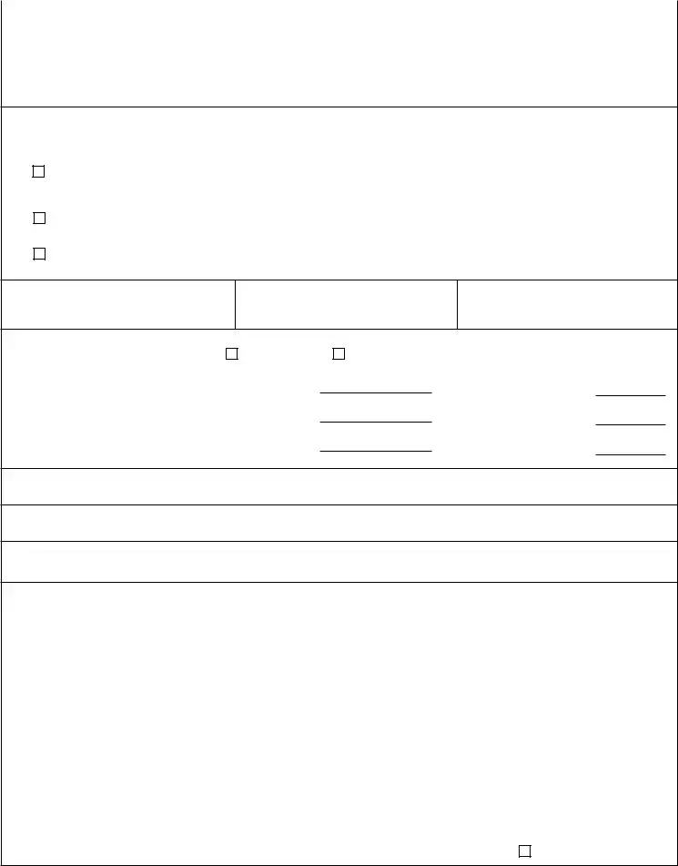
SECTION D – SURVEYOR, ENGINEER, OR ARCHITECT CERTIFICATION
This certification is to be signed and sealed by a land surveyor, engineer, or architect authorized by law to certify elevation information. I certify that the information on this Certificate represents my best efforts to interpret the data available. I understand that any false statement may be punishable by fine or imprisonment under 18 U.S. Code, Section 1001.
Were latitude and longitude in Section A provided by a licensed land surveyor? |
Yes |
No |
Check here if attachments. |
||
|
|
|
|
|
|
Certifier's Name |
License Number |
|
|
|
|
|
|
|
|
|
|
Title |
|
|
|
|
|
|
|
|
|
|
|
Company Name |
|
|
|
|
|
|
|
|
|
|
|
Address |
|
|
|
|
|
|
|
|
|
|
|
City |
State |
ZIP Code |
|
|
|
|
|
|
|
|
|
Signature |
Date |
Telephone |
|
Ext. |
|
Copy all pages of this Elevation Certificate and all attachments for (1) community official, (2) insurance agent/company, and (3) building owner. Comments (including type of equipment and location, per C2(e), if applicable)
FEMA Form |
Replaces all previous editions. |
Form Page 2 of 6 |
ELEVATION CERTIFICATE |
|
|
OMB No. |
|
|
|
Expiration Date: November 30, 2022 |
||
IMPORTANT: In these spaces, copy the corresponding information from Section A. |
FOR INSURANCE COMPANY USE |
|||
Building Street Address (including Apt., Unit, Suite, and/or Bldg. No.) or P.O. Route and Box No. |
Policy Number: |
|||
|
|
|
|
|
City |
State |
ZIP Code |
Company NAIC Number |
|
SECTION E – BUILDING ELEVATION INFORMATION (SURVEY NOT REQUIRED)
FOR ZONE AO AND ZONE A (WITHOUT BFE)
For Zones AO and A (without BFE), complete Items
E1. Provide elevation information for the following and check the appropriate boxes to show whether the elevation is above or below the highest adjacent grade (HAG) and the lowest adjacent grade (LAG).
a)Top of bottom floor (including basement, crawlspace, or enclosure) is
b)Top of bottom floor (including basement, crawlspace, or enclosure) is
feet |
meters |
above or |
below the HAG. |
feet |
meters |
above or |
below the LAG. |
E2. |
For Building Diagrams |
||||||||
|
the next higher floor (elevation C2.b in |
|
|
|
|
feet |
meters |
above or |
below the HAG. |
|
the diagrams) of the building is |
|
|
|
|
||||
E3. |
Attached garage (top of slab) is |
|
|
|
|
feet |
meters |
above or |
below the HAG. |
|
|
|
|
||||||
E4. |
Top of platform of machinery and/or equipment |
|
|
|
|
|
|
|
|
|
servicing the building is |
|
|
|
|
feet |
meters |
above or |
below the HAG. |
|
|
|
|
|
|||||
E5. |
Zone AO only: If no flood depth number is available, is the top of the bottom floor elevated in accordance with the community's |
||||||||
|
floodplain management ordinance? |
Yes |
No |
Unknown. The local official must certify this information in Section G. |
|||||
SECTION F – PROPERTY OWNER (OR OWNER'S REPRESENTATIVE) CERTIFICATION
The property owner or owner's authorized representative who completes Sections A, B, and E for Zone A (without a
Property Owner or Owner's Authorized Representative's Name
|
Address |
City |
State |
ZIP Code |
|
|
|
|
|
|
|
|
Signature |
Date |
Telephone |
|
|
|
|
|
|
|
|
|
Comments |
|
|
|
|
|
|
Check here if attachments. |
|
|
|
FEMA Form |
Replaces all previous editions. |
Form Page 3 of 6 |
ELEVATION CERTIFICATE |
|
|
OMB No. |
|
|
|
Expiration Date: November 30, 2022 |
||
IMPORTANT: In these spaces, copy the corresponding information from Section A. |
FOR INSURANCE COMPANY USE |
|||
Building Street Address (including Apt., Unit, Suite, and/or Bldg. No.) or P.O. Route and Box No. |
Policy Number: |
|||
|
|
|
|
|
City |
State |
ZIP Code |
Company NAIC Number |
|
|
|
|
|
|
SECTION G – COMMUNITY INFORMATION (OPTIONAL)
The local official who is authorized by law or ordinance to administer the community's floodplain management ordinance can complete Sections A, B, C (or E), and G of this Elevation Certificate. Complete the applicable item(s) and sign below. Check the measurement used in Items
G1.
The information in Section C was taken from other documentation that has been signed and sealed by a licensed surveyor, engineer, or architect who is authorized by law to certify elevation information. (Indicate the source and date of the elevation data in the Comments area below.)
G2.
G3.
A community official completed Section E for a building located in Zone A (without a
The following information (Items
G4. Permit Number
G5. Date Permit Issued
G6. Date Certificate of Compliance/Occupancy Issued
G7. This permit has been issued for: |
New Construction |
Substantial Improvement |
G8. Elevation of
G9. BFE or (in Zone AO) depth of flooding at the building site:
G10. Community's design flood elevation:
Local Official's Name |
Title |
 feet
feet 
 meters Datum
 feet
feet 
 meters Datum
 feet
feet 
 meters Datum
Community Name |
Telephone |
Signature |
Date |
Comments (including type of equipment and location, per C2(e), if applicable)
Check here if attachments.
FEMA Form |
Replaces all previous editions. |
Form Page 4 of 6 |

ELEVATION CERTIFICATE |
BUILDING PHOTOGRAPHS |
OMB No. |
||
See Instructions for Item A6. |
Expiration Date: November 30, 2022 |
|||
IMPORTANT: In these spaces, copy the corresponding information from Section A. |
FOR INSURANCE COMPANY USE |
|||
Building Street Address (including Apt., Unit, Suite, and/or Bldg. No.) or P.O. Route and Box No. |
Policy Number: |
|||
|
|
|
|
|
City |
State |
ZIP Code |
Company NAIC Number |
|
|
|
|
|
|
If using the Elevation Certificate to obtain NFIP flood insurance, affix at least 2 building photographs below according to the instructions for Item A6. Identify all photographs with date taken; "Front View" and "Rear View"; and, if required, "Right Side View" and "Left Side View." When applicable, photographs must show the foundation with representative examples of the flood openings or vents, as indicated in Section A8. If submitting more photographs than will fit on this page, use the Continuation Page.
|
Photo One |
||
Photo One Caption |
|
Clear Photo One |
|
|
|
|
|
|
Photo Two |
||
Photo Two Caption |
|
Clear Photo Two |
|
|
|
|
|
FEMA Form |
Replaces all previous editions. |
Form Page 5 of 6 |

ELEVATION CERTIFICATE |
BUILDING PHOTOGRAPHS |
OMB No. |
|
|
Continuation Page |
Expiration Date: November 30, 2022 |
|
IMPORTANT: In these spaces, copy the corresponding information from Section A. |
FOR INSURANCE COMPANY USE |
||
Building Street Address (including Apt., Unit, Suite, and/or Bldg. No.) or P.O. Route and Box No. |
Policy Number: |
||
|
|
|
|
City |
State |
ZIP Code |
Company NAIC Number |
|
|
|
|
If submitting more photographs than will fit on the preceding page, affix the additional photographs below. Identify all photographs with: date taken; "Front View" and "Rear View"; and, if required, "Right Side View" and "Left Side View." When applicable, photographs must show the foundation with representative examples of the flood openings or vents, as indicated in Section A8.
|
Photo Three |
Photo Three Caption |
Clear Photo Three |
|
Photo Four |
||
Photo Four Caption |
|
Clear Photo Four |
|
|
|
|
|
FEMA Form |
Replaces all previous editions. |
Form Page 6 of 6 |
Form Characteristics
| Fact Name | Details |
|---|---|
| Purpose of the Elevation Certificate | The Elevation Certificate is crucial for providing elevation data necessary for compliance with floodplain management ordinances and determining flood insurance rates. |
| Required for Post-FIRM Buildings | The certificate is mandatory for buildings constructed after the Flood Insurance Rate Map (FIRM) publication, specifically in designated flood zones. |
| Community Compliance | Communities participating in the National Flood Insurance Program (NFIP) must use the Elevation Certificate to document compliance with their floodplain management regulations. |
| Privacy Act Compliance | The collection and disclosure of information on the Elevation Certificate adhere to privacy laws, ensuring data is used primarily for estimating risk premiums for flood insurance. |
| Surveyor Certification Required | The Elevation Certificate must be signed by a licensed surveyor, engineer, or architect, ensuring the accuracy of the elevation data provided. |
| Not Required for Pre-FIRM Buildings | Pre-FIRM buildings do not need an Elevation Certificate unless they are being rated under the optional Post-FIRM flood insurance rules. |
Guidelines on Utilizing Fema Elevation
Completing the FEMA Elevation Certificate requires careful attention to detail and accurate information. This document helps support flood insurance applications and compliance with community regulations. Follow the steps below to ensure the form is filled out correctly.
- Obtain a copy of the FEMA Elevation Certificate form, which is often available online or through your insurance provider.
- Start with Section A - Property Information: Enter the building owner's name, address, and relevant property details. Include the property description and building use. Also, provide latitude and longitude, and attach at least two photographs of the building.
- Proceed to Section B - Flood Insurance Rate Map (FIRM) Information: Fill in the community name, county name, state, map/panel number, and effective date of the FIRM. Indicate the flood zones and base flood elevation source.
- Complete Section C - Building Elevation Information: Provide the necessary elevations, noting whether they are based on construction drawings or finished construction. Ensure proper measurements are taken based on the building diagram.
- Fill in Section D - Surveyor, Engineer, or Architect Certification: This section must be signed and sealed by a qualified professional. It confirms the accuracy of the information provided.
- For buildings in Zone AO or without BFE, complete Section E: Provide elevation details for the bottom floor and other relevant structures. Ensure to check whether the elevation is above or below adjacent grade.
- Finally, in Section F - Property Owner Certification: The property owner or their representative must sign this section, confirming the accuracy of the information submitted.
- Make copies of the completed Elevation Certificate for your records. Distribute copies to the community official, insurance agent, and building owner as required.
What You Should Know About This Form
What is the purpose of the FEMA Elevation Certificate?
The FEMA Elevation Certificate serves multiple important functions within the National Flood Insurance Program (NFIP). Its primary role is to provide elevation data needed to verify compliance with local floodplain management ordinances. This information is crucial for determining flood insurance premium rates. Additionally, the Elevation Certificate is essential when requesting a Letter of Map Amendment (LOMA) or a Letter of Map Revision based on fill (LOMR-F). It helps document that new or substantially improved structures meet necessary elevation requirements to minimize flood risk.
Who needs to complete the Elevation Certificate?
The Elevation Certificate must be completed by a licensed land surveyor, engineer, or architect. This individual will assess and certify the building’s elevations, ensuring the accuracy of the information provided. If the building is located in a flood zone and is subject to NFIP regulations, the property owner may also need to complete sections of the form to provide details about the property. It’s important to note that a new Elevation Certificate will be necessary upon completion of construction if the initial certificate was based on drawings or a building under construction.
Is the Elevation Certificate required for all properties?
No, the Elevation Certificate is not required for all properties. It is specifically needed for buildings constructed after the Flood Insurance Rate Map (FIRM) was published, particularly those in designated flood zones like A1-A30, AE, AH, VE, and others. Pre-FIRM buildings typically do not need an Elevation Certificate unless they are being rated under the optional Post-FIRM flood insurance rules. Failure to provide the Elevation Certificate when required may result in higher flood insurance premium rates or potential issues with securing flood insurance entirely.
What happens if the information on the Elevation Certificate is incorrect?
Submitting incorrect information on the Elevation Certificate can lead to significant consequences. If inaccuracies are found, it may affect the flood insurance premium rates, and it could potentially void the insurance altogether. Moreover, providing false statements is punishable under federal law. Therefore, it is crucial to ensure that all data recorded in the Elevation Certificate is accurate and verified by a qualified professional. It is recommended to review the certificate thoroughly before submission to minimize any risks associated with misinformation.
Common mistakes
Filling out the FEMA Elevation Certificate can seem simple, but several common mistakes can lead to complications. One frequent error is failing to provide accurate elevation data. This includes not using the correct vertical datum or the appropriate measurement units. When the elevation information is inaccurately recorded, it can negatively affect the insurance premiums and even complicate floodplain management efforts.
Another mistake involves overlooking necessary supporting documentation. Some applicants forget to attach required photographs or illustrations of the property. This can create issues during the review process, as insurance companies and community officials rely on this additional information for validation. Ensure you gather and organize all required documentation before submitting the form.
Many people also mistakenly enter incomplete or incorrect property descriptions. Details such as legal descriptions, lot numbers, and block numbers must be fully and accurately reported. Missing these can lead to delays and possible challenges in obtaining flood insurance, as the application might not provide enough clarity for the insurance provider.
In addition to the above, a common oversight is failing to verify that the elevation data complies with the location’s Flood Insurance Rate Map (FIRM). Each elevation reported must correspond accurately to the designated flood zone. Incorrect associations can result in higher insurance rates and regulatory issues down the line.
Another prevalent mistake is incorrect certification from surveyors or engineers. The information must be certified to confirm its accuracy, but sometimes, individuals neglect to ensure that their certifier possesses the appropriate qualifications. An unqualified certifier’s signature can invalidate the entire certificate.
Lastly, many people skip reviewing community-specific floodplain management regulations. Understanding what your community requires is essential, as local ordinances can differ from federal rules. Ignoring these requirements can complicate the insurance process and may even lead to fine penalties in some jurisdictions.
Documents used along the form
The FEMA Elevation Certificate is a vital document that plays a crucial role in ensuring compliance with national flood insurance requirements and local floodplain management ordinances. However, it is often accompanied by several other forms and documents, each serving a unique purpose in the context of flood management and insurance. Below is a list of commonly used documents alongside the Elevation Certificate.
- Letter of Map Amendment (LOMA): This document is used to amend FEMA's Flood Insurance Rate Map (FIRM). If a property is incorrectly indicated as being located in a Special Flood Hazard Area (SFHA), a LOMA can effectively remove it from that designation.
- Letter of Map Revision (LOMR): Similar to a LOMA, a LOMR is a formal adjustment made to the FIRM. This is typically requested after changes in land use or construction that affect flooding dynamics. It updates the mapped flood risks for an area.
- Floodproofing Certificate: If a non-residential building has been designed to withstand floodwaters, this certificate is necessary. It certifies that the structure is floodproofed up to or above the Base Flood Elevation (BFE).
- FEMA MT-EZ Form: This form is submitted to support requests for a LOMA or LOMR. It gathers necessary elevation data for properties in SFHA that may have been misclassified.
- FEMA MT-1 Form: Similar to the MT-EZ, the MT-1 form is used for more complex map change requests, providing additional details as needed to support the property owner's case.
- FEMA Form 81-31 (Community Rating System Application): This application enables communities to participate in the CRS, which allows for discounts in flood insurance premiums based on certain floodplain management criteria.
- Local Floodplain Management Ordinance: A community-specific document that outlines regulations and practices for managing flood risks. It is essential for compliance with local requirements and typically dictates minimum standards for construction in flood-prone areas.
- Construction Drawings: These documents provide architectural details and specifications about a building's design. They are often required for a comprehensive evaluation regarding flood risks and compliance with elevation requirements.
Understanding these accompanying forms and documents aids property owners in navigating the complexities of flood insurance and management. Together, they ensure that communities and individuals are adequately protected against flood risks while promoting safe construction practices. Having the right documentation in hand can make a significant difference when seeking flood insurance or modifying flood zone designations.
Similar forms
The FEMA Elevation Certificate serves multiple purposes related to flood insurance and community floodplain management. It is essential to understand how this document compares to others that provide similar functions or authority. The following documents share similar attributes with the FEMA Elevation Certificate:
- Letter of Map Amendment (LOMA): A LOMA allows property owners to request a modification to the flood zone designation of their property, which can help them avoid mandatory flood insurance. Like the Elevation Certificate, LOMA requires elevation data to establish that the property is above the Base Flood Elevation.
- Floodproofing Certificate: This document is necessary when non-residential buildings are designed to be watertight below the Base Flood Elevation. It serves a role akin to the Elevation Certificate by documenting compliance with floodproofing standards to reduce flood risk.
- Flood Insurance Rate Map (FIRM): A FIRM delineates flood hazard zones and provides crucial information on flood risks to property owners. It complements the Elevation Certificate by providing the overall context of flood risk and insurance premiums based on property elevation.
- Elevation Survey: Conducted by a licensed surveyor, this survey provides specific measurements of a building's elevation relative to various benchmarks. Similar to the Elevation Certificate, it ensures compliance with floodplain management ordinances and supports flood insurance applications.
- Building Permit Application for Floodplain Development: When a property is developed or improved in a floodplain, a building permit application must demonstrate compliance with local floodplain management regulations. This application shares the purpose of documenting elevation and flood risk management, much like the Elevation Certificate.
Dos and Don'ts
When filling out the FEMA Elevation Certificate form, clarity and accuracy are paramount. Adhering to best practices can significantly enhance the effectiveness of your submission. The following guidelines detail essential dos and don’ts during the process:
- Do ensure that all required sections are completed accurately.
- Do attach at least two photographs of the building.
- Do use the correct elevation datum, as specified in the document.
- Do retain copies of all submitted pages for personal records and to provide to the community official and insurance agent.
- Do verify that the building diagram number corresponds to the structure being evaluated.
- Don't leave any fields blank unless they are marked as optional.
- Don't use outdated forms; ensure you are using the most current version as provided by FEMA.
- Don't submit the Elevation Certificate to the address listed in the instructions; it is only for comments.
- Don't falsify any information, as inaccuracies can lead to legal consequences.
Following these recommendations will help facilitate a smoother review process and could lead to more favorable outcomes regarding flood insurance and community compliance.
Misconceptions
- Misconception 1: The FEMA Elevation Certificate is only for new construction.
- Misconception 2: Completing the Elevation Certificate is optional.
- Misconception 3: An Elevation Certificate can guarantee lower flood insurance premiums.
- Misconception 4: The Elevation Certificate is only relevant for insurance purposes.
- Misconception 5: You can skip submitting the Elevation Certificate to FEMA if you have a LOMA.
- Misconception 6: Anyone can fill out the Elevation Certificate.
- Misconception 7: Elevation Certificates are valid indefinitely.
This is not the case. The Elevation Certificate can also apply to substantially improved structures. If a building has been altered, they may still need an Elevation Certificate, even if it wasn’t newly constructed.
In fact, for properties in certain flood zones, completing the Elevation Certificate is a requirement. It helps determine flood insurance rates and assists with local floodplain management regulations.
While an Elevation Certificate provides critical data, it does not guarantee lower insurance rates. Premiums are influenced by various factors, including the property's elevation relative to flood zones.
The certificate also plays an important role in community floodplain management. Local governments use it to ensure compliance with their floodplain ordinances.
This is incorrect. A licensed surveyor, engineer, or architect must complete the certificate to ensure accurate and legal compliance with flood elevation data.
This is not true. Elevation Certificates typically have a validity period that depends on changes to the property or updates in local flood maps. Regular reviews are necessary to maintain accurate records.
Key takeaways
Here are nine key takeaways about filling out and using the FEMA Elevation Certificate:
- The Elevation Certificate is essential for estimating flood insurance premiums and ensuring compliance with floodplain management ordinances.
- Understanding your property's flood zone designation is crucial, as the certificate is required for properties in specific zones outlined by FEMA, such as AE and VE.
- The certificate must be completed by a professional surveyor, engineer, or architect who can certify the building's elevations.
- Important photographs of the building must be attached to the Elevation Certificate if it is being used for flood insurance purposes.
- The highest and lowest adjacent grades need to be documented, as they are critical for determining flood risk and insurance rates.
- If the Elevation Certificate supports a Letter of Map Amendment (LOMA) or a Letter of Map Revision based on fill (LOMR-F), specific elevation data must be included, verified by an authorized professional.
- Non-residential buildings can be floodproofed up to the Base Flood Elevation (BFE), but separate documentation is required for floodproofing certificates.
- Failure to provide the information requested may hinder flood insurance approval or lead to higher premium rates.
- Copies of the completed Elevation Certificate should be shared with the community official, insurance agent, and property owner for their records.
Browse Other Templates
Free Massage Intake Forms - Clients report if they are sensitive to touch to enhance comfort levels.
Tax Exempt Form Massachusetts - Selecting the correct boxes on the ST-12 is essential to ensure the tax exemption is applied properly.
Lynn University Transcript - It is crucial for students to carefully fill out the form to ensure timely processing and delivery.